Tuesday, April 1, 2014

Assisi to Nocera Scalo

Took a good trek the other day, from Assisi to Nocera Scalo and back. The latter town is a quiet hamlet with a train stop, but there's plenty of good hiking in between. Started out via Porta Perlici around 6:30 a.m.
It was a fine morning, cool and brisk, good walking weather.
After about three miles on a country road, it was time to turn off on an unmarked gravel one.
From this point on, my route switched back and forth between maintained or unmaintained trails, gravel roads and old dirt roads, some moves necessitated by recent rains. Certain parts of the trails were sure to be very muddy, while other parts just looked like this.
After a couple of hours, the clear day allowed for a good distant view back at Assisi, in the far center of the picture.
Passed through the hamlet of Satriano, and soon came to the tiny church of San Leonardo. The original church has a history going back to the Fourteenth Century.
Here's the inside.
A view of a pond, with Subasio in the distance.
Opted to walk a long stretch of road over trying to navigate a trail mud swamp, and finally the ruins of Rocca di Postignano came into sight. This fortress dates back to the Tenth Century, when it was inhabited by Lombard nobles.
Here's a closer view of the top of the fortress.
And remains of some of the structures below.
Terrific views from the Rocca (guess a wisely built fortress would offer distant views of any potential visitors), looking back toward Subasio.
From Rocca di Postignano, it was a combination of road and muddy trail trekking down to the hamlet of Villa di Postignano.
Stopped in at the small church there, where Sunday Mass was just ending, with a congregation of perhaps 20 persons.
From there, Nocera Scalo was a downhill stroll. Arrived there about five hours after setting out. Looked about for a bit. A nice river flows through town.
There was a small shrine on the main road.
What also caught my eye (and ear), was a loudly barking dog on a roof. 
Not sure if Nocera Scalo dogs in general spend much time on their roofs, but what also was interesting, particularly in late March, was the presence of a nativity scene.
Time to head back to Assisi. Roundtrip the walk was about twenty-five miles, under eleven hours, with, of course, many more great views on the return.
Ciao.

Thursday, March 27, 2014

Around Assisi

It's a cold and rainy March day in Assisi. Winter seems to be having trouble letting go. A short walk to the Basilica of Saint Clare this morning turned into a drenching, umbrella-inverting adventure. Now seems a good time to post a few odds and ends pictures from around town. First, an evening view of the Torre del Popolo, the tower overlooking the Piazza del Comune.
Next, a manger scene from a storefront window.
Here's a heavy duty lightweight truck. Small, practical, three-wheel trucks are popular here, but even in Italy there seems a temptation to upgrade.
A view through the wall of the Rocca Maggiore fortress.
Signs of Spring.
Another view of town from above.
A photo, posted in the Church of Santa Maria Maggiore, of a priest often seen there and at the small Church of San Stefano, meeting with a special visitor.
A fresco in the Church of Santa Maria Maggiore.
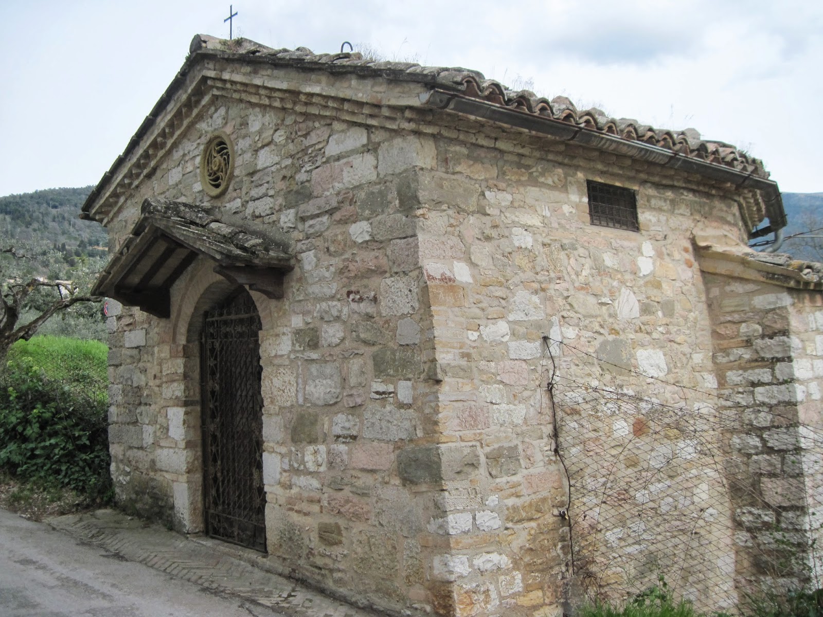
This is the tiny Chapel of San Feliciano, along the path between Assisi and San Damiano. It's gated closed, and I've never seen it open. However, there is a small opening in the wooden entrance door, just enough to look through.
Here is within.
Ciao.

Wednesday, March 26, 2014

Atop Colcaprile

To the north of Assisi, on the west side of Mount Subasio, is a rise called Colcaprile, that may be described as a small mountain or a large hill. Here's a picture.
For a long while I thought the mountain-hill on the left was Colcaprile, and technically it may be part of it. However, the actual summit can be seen further back, just to the right of the front rise, and is of course higher, though it may not appear so from this angle. Mount Subasio rises up on the right of the picture.
I had hiked up in the direction of Colcaprile in the past, but had found no signs or access for the summit. (There are "Colcaprile" signs along the way for an event facility of that name, a fenced off enclosure, but no trail markers.)
This time I again followed country roads down from Assisi and up through rural settings to the left of the above picture. However, when the summit came in view, it was time to turn off on some unmarked dirt roads and, after a few false starts, to follow one winding along in the right direction. Unfortunately, part way in it was fenced off with barbed wire, and there was no welcome sign.
However, as may be observed, there also were no private property keep out beware of the dogs trespassers will be prosecuted signs, which is just about as good as a warm welcome. Then, there it was, off to one side, an inviting opening with enough space to squeeze through.
The summit was an easy uphill trek from there, and afforded some good views, this one looking back toward Assisi.
The walk also included some fine views of a less visited side of Assisi. In this picture one can see the Rocca Maggiore on the left, the cemetery sitting lower in the center and the Basilica of Saint Francis on the right.
Finally, going and returning one passes over an old bridge (rebuilt over time) that was crossed by Charlemagne's troops on their way to Rome for him to be crowned Holy Roman Emperor.
Over twelve centuries ago, undeterred by barbarians or barbed wire.
Ciao.

Monday, March 24, 2014

A Special Place on Colle San Rufino

High up on Mount Subasio is a steep hill called Colle San Rufino, that sits prominently on the Assisi side of the mountain. Many hikers going up and down the mountain might pass it by without much thought. It first came to my attention years ago when I saw horses grazing atop it. It turns out to be a place of archeological significance predating Assisi, and ruins can be found along the ridge of the hill.
I visited Colle San Rufino on a recent climb of Subasio, but not before taking a "shoefie" on the mountain summit.
Really, this was taken very close to the summit marker.
The trek back down included crossing over the top of Colle San Rufino and revisiting an interesting, unmarked location carved into the rocky hillside, that some person or persons years ago transformed into a rough shrine. Here are a few pictures, the first looking down from above.
Next from the side.
Here are some closer pictures, starting with a manger scene (with a fallen cow).
Another manger scene, sheltered by plastic.
 Two venerated saints.
A quote (trans: Two things in the world will never abandon you: the eye of God that always sees you, the heart of the Mother that always follows you) and a cross.
Saint Catherine of Siena.
The Basilica of Saint Francis in Assisi.
Sacred Art.
With inspiring views of Subasio above and the valley below, Colle San Rufino is a special place to visit.
Ciao.

Thursday, March 20, 2014

Revisiting Gabbiano Vecchio

Deep in the forest on the Spello side of Mount Subasio, unmarked by any signs and accessible only by a narrow path, lies the remains of a town called Gabbiano Vecchio (Old Seagull). I've posted about it in the past and revisited it on a recent hike. Thus far, I've been able to discover very little of the history of Gabbiano Vecchio. What remains are parts of a few structures, the gem of which is the Chiesa di Sant'Antonio (Church of Saint Anthony). I'm told by an art expert that the frescoes within are likely 17th Century. The church is in the process of decay, so its treasures may not not be around much longer. Here's the path into Gabbiano Vecchio.
Approaching the church.
The altar area.
Saint Anthony.
The dilapidated ceiling.
As seen from the forest.
A word of advice to any hikers: there are poisonous viper snakes in this area. I've never seen one, but it would be wise to avoid stepping or reaching into dark places or dense growth. With an ounce of caution you should have no problems.
Gabbiano Vecchio is a unique and special place.
Ciao.