Thursday, October 28, 2010

Cartagena, Colombia

Indigenous peoples already had been living in this part of Colombia for thousands of years when, in 1533, Spaniard Pedro de Herdia founded Cartagena de Indias.  Many buildings remain from the past few centuries.
Cartagena has a history of being attacked or plundered, including one 1741 raid involving George Washington's brother (a bit of trivia).  The older part of the city is still surrounded by walls.
A clock tower marks an entrance to the city.
Scenes from colorful older neighborhoods.


Street vendors are commonplace throught the city.  Watermelon anyone?
Or perhaps a coconut?
Plenty of shoeshine business.
While there is much automobile traffic, some still use healthier modes of transportation.
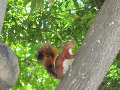
Finally, a glimpse of urban Cartagena wildlife.
And plant life.
Ciao.

Wednesday, October 27, 2010

Panama Canal

Now nearly 100 years old, the Panama Canal was an extraordinary engineering achievement, although many lives were lost in its construction.  How does it work?  Simply stated, ships traveling between the Pacific and the Carribean (or vice versa) enter locks to raise them to higher water, then travel about 48 miles of waterways before being lowered through locks near the opposite coast.  Here's what it looks like entering a lock.
The gates are opening.
The locks were built to accomodate large ships, by 1914 standards.  The width of this lock is about 110 feet.
Plenty of room to spare, since this ship is only about 105.6 feet in width.  Understandably, rail cars are used to tow ships through the locks, rather than expecting ships to stop, start and navigate a very narrow channel without doing much damage.
Here's a carge ship in an adjacent lock.  Not much room to spare there.  Work is underway to build wider locks for the future.
Looking back over closed gates.
Most traverse the Panama Canal between between the Carribean and the Pacific.  Some follow a shorter route.
From the locks one can see the Bridge of the Americas, a main road through Panama.
A closer look at the bridge.
There's plenty of rugged Panamanian terrain.
One might imagine that the canal runs west-east between the Pacific and the Carribean.  However, because of the way the Panama Isthmus curves, the journey is actually south-north.  Here's another waterway view.
Soon it's lowering through more locks and on to the Carribean.
Ciao.

Under the Golden Gate Bridge & Puntarenas, Costa Rica

It's been a while since I've posted, but we recently traveled south from California and took some pictures.  Here are three posts, first San Francisco and Puntarenas, Costa Rica, second the Panama Canal, and third Cartagena, Colombia.  We set out to sea from San Francisco.
But not before watching a plane fly under the Golden Gate Bridge.
Approaching the bridge from a distance.
Closer...
And closer...
And underneath!

Puntarenas is a west coast port of Costa Rica, a country with much natural beauty, diversity and, I think, the largest nation on earth with no standing army.  Costa Ricans call themselves "Ticos" and enjoy an ecologically rich land of mountains, volcanos, jungles, cloud forests, beaches and welcoming communities, all within close proximity.  Add to that a great climate.  Here is a Puntarenas church on a Sunday morning.
A church window.
Here's an interesting store.
An old but colorful abandoned building.
And speaking of colorful...
Here is "Uncle Carlos' Parking Lot."  Please don't block the entrance!
Finally, some seaside vendors.
Hope to be back soon with Panama and Cartagena pictures. Ciao